Marine Litter Monitoring with Remote Sensing and AI Models
Marine plastic pollution is hard to measure at scale: field surveys are costly and sparse, so we use remote sensing for repeatable coverage—making detection robust across conditions, sensors, and geographies. Our research develops end-to-end, multi-scale monitoring pipelines that connect in-situ and camera observations (ground truth and process understanding), controlled field experiments (detectability limits and calibration), and large-scale satellite monitoring to map and track litter hotspots over time.
Exploring plastic detectability on riverbanks using remote sensing (SSRN Preprint, 2025, under review)
Main contributions:
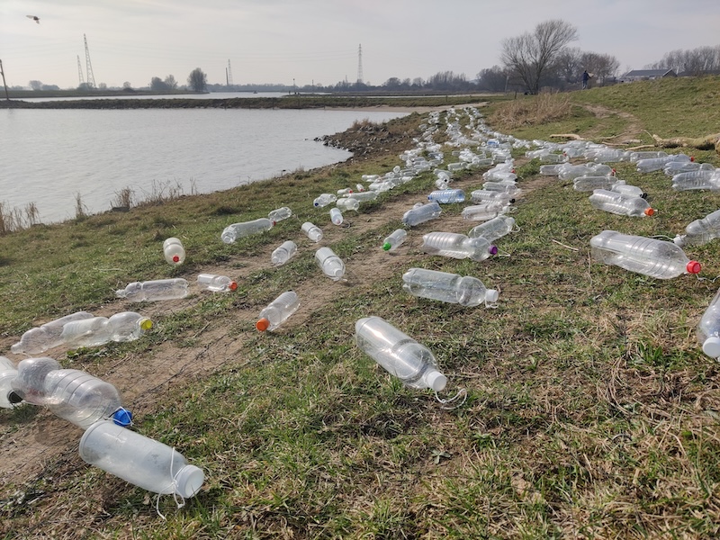
- Runs a controlled riverbank target experiment with multiple sensors (field spectrometer, close-range multispectral, Sentinel-2, PlanetScope, EnMAP).
- Proposes a detectability workflow (incl. a new index and a simple classifier) and shows polyester sheets can be detected at larger sizes, while PET bottle targets were not detected in this setup.
- Derives practical limits: detectability is constrained by spatial resolution and plastic concentration.
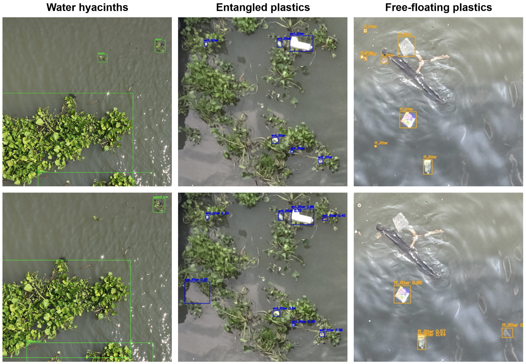
Exploring Transferability of Plastic-Water Hyacinth Interaction and Detection in Rivers (SSRN Preprint, 2025, under review)
Main contributions:
- Studies how floating plastics become entangled in water hyacinths, enabling monitoring via a natural “proxy” that concentrates plastics.
- Evaluates transferability of object detection models across rivers (including performance gaps between entangled vs. free-floating plastics).
- Combines imagery-based detection with physical sampling, highlighting differences between what is visible from imagery and what is present in-situ.
River plastic hotspot detection from space (iScience, 2025)
Main contributions:
- Presents a semi-automated, cloud-based pipeline combining satellite remote sensing + machine learning to detect riverine plastic hotspot locations.
- Uses multi-sensor imagery (incl. Sentinel-2 and PlanetScope) and emphasizes scalable, reproducible processing (via a cloud workflow).
- Demonstrates transfer across geographies (case studies across rivers in Ghana, Indonesia, and Guatemala) and highlights the continued need for in-situ validation.
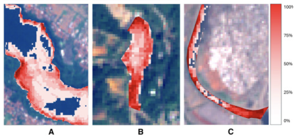
Large-scale Detection of Marine Debris in Coastal Areas with Sentinel-2 (iScience, 2023)
Main contributions:
- Introduces a pixel-wise marine debris detector (deep segmentation) for medium-resolution Sentinel-2 imagery.
- Shows that performance gains come largely from data-centric design (many hard negatives + label refinement), not just architecture tweaks.
- Releases model weights and training code to support reproducible large-scale monitoring.
Using Double-Acquisition of Sentinel-2 Planescope to estimate drift directions
Snap Snap Track (Open Mind proposal concept, 2025) with Joost van Dalen
Folkert Hellinga MSc Award for Gabriele Tijunaityte for her MSc thesis: double acquisition across sensors (2025)
- MSc thesis exploring double-image / multi-sensor acquisition strategies for monitoring drifting marine litter.
SAMSelect: A Spectral Index Search for Marine Debris Visualization using Segment Anything (IEEE Geoscience and Remote Sensing Letters, 2025)
Main contributions:
- Develops SAMSelect, an algorithm that automates spectral band / index selection for 3-channel visualizations by using Segment Anything (SAM) as a proxy for expert visual photo-interpretation.
- Performs an exhaustive search over band composites and spectral-index families, selecting the visualization that maximizes agreement (IoU) between SAM segmentations and a small set of expert annotations.
- Discovers previously underused band combinations for marine debris visualization (e.g., NDI(B2, B8)) that improve over common baselines like NDVI and FDI in the evaluated Sentinel-2 scenes.
- Positions the approach as a general-purpose workflow for quickly finding salient visualizations for other multispectral sensors and applications.
What’s next
Current focus areas:
- Cross-scale validation: connecting camera/field observations to satellite detections.
- Robust generalization: reducing false positives via better negatives, site diversity, and uncertainty-aware outputs.
- Operational monitoring: turning detectors into repeatable coastal and river monitoring products (with transparent evaluation and open baselines).