Research
Research Topics
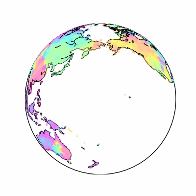
Earth Embeddings and Geospatial Representation Learning
2023 - ongoing
Learning general-purpose representations that capture spatial, temporal, and contextual signals across Earth observation data.
Learn More
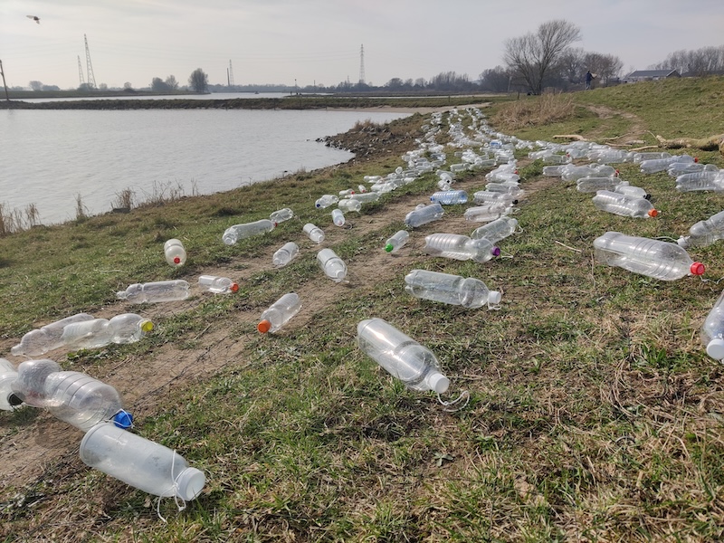
Marine Litter Monitoring with Remote Sensing and AI Models
2021 - ongoing
Detecting and tracking marine debris from multi-sensor imagery to support monitoring and response.
Learn More
Few-Shot Meta-Learning and Transfer Learning
2020 - 2023
Designing models that adapt quickly to new regions, sensors, and tasks with minimal labeled data.
Learn More
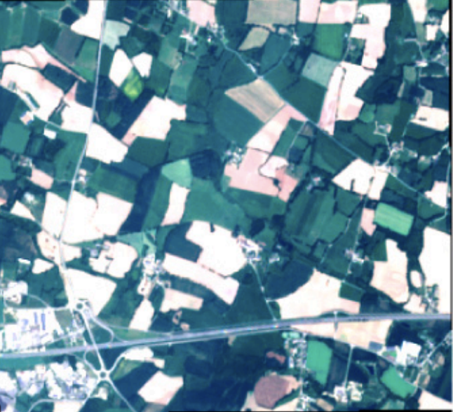
Large-scale Crop Type Mapping with Deep Time Series Classifiers
2018 - 2021
Scalable crop-type mapping from Sentinel time series, with models that generalize across regions and can deliver reliable in-season predictions.
Learn More
Publications
- Measuring The Intrinsic Dimension Of Earth Representations — arXiv (Cornell University) (2025)
- On The Added Value Of Sequential Deep Learning For The Upscaling Of Evapotranspiration — Biogeosciences (2025)
- Earth Embeddings: Harnessing The Information In Earth Observation Data With Machine Learning — (2025)
- SatCLIP: Global, General-Purpose Location Embeddings With Satellite Imagery — Proceedings of the AAAI Conference on Artificial Intelligence (2025)
- Autoregressive Denoising Diffusion For Predicting Trajectories Of Floating Objects In Oceans — (2025)
- A Cross-Sensor Approach For Marine Litter Detection With Self-Supervised Learning — (2025)
- AirCast: Improving Air Pollution Forecasting Through Multi-Variable Data Alignment — arXiv (Cornell University) (2025)
- Time, Space, Or Both? A Comparison Of Flexible Spatio-Temporal Deep Learning Architectures To Map Tree Cover Loss From Sentinel-2 Data — SSRN Electronic Journal (2025)
- Scalable Classification Of Riverine Plastic Hotspots Using Sentinel-2 And Cloud-Based Machine Learning — SSRN Electronic Journal (2025)
- SAMSelect: A Spectral Index Search For Marine Debris Visualization Using Segment Anything — IEEE Geoscience and Remote Sensing Letters (2025)
- Deep Pre-Trained Time Series Features For Tree Species Classification In The Dutch Forest Inventory — SSRN Electronic Journal (2025)
- Better, Not Just More: Data-Centric Machine Learning For Earth Observation — IEEE Geoscience and Remote Sensing Magazine (2024)
- On The Added Value Of Sequential Deep Learning For Upscaling Evapotranspiration — (2024)
- Mapping Drivers Of Tropical Forest Loss With Satellite Image Time Series And Machine Learning — Environmental Research Letters (2024)
- WildCLIP: Scene And Animal Attribute Retrieval From Camera Trap Data With Domain-Adapted Vision-Language Models — International Journal of Computer Vision (2024)
- Multi-Temporal Forest Monitoring In The Swiss Alps With Knowledge-Guided Deep Learning — Remote Sensing of Environment (2024)
- Imbalance-Aware Presence-Only Loss Function For Species Distribution Modeling — arXiv (Cornell University) (2024)
- Analyzing Spatio-Temporal Machine Learning Models Through Input Perturbation — (2024)
- Linking Deep Learning-Based Forest Cover Maps To Treeline Spatio-Temporal Patterns — (2024)
- Where The White Continent Is Blue: Deep Learning Locates Bare Ice In Antarctica — Geophysical Research Letters (2024)
- Datasets For "Where The White Continent Is Blue: Deep Learning Locates Bare Ice In Antarctica" — Zenodo (CERN European Organization for Nuclear Research) (2024)
- Meta-Learning To Address Diverse Earth Observation Problems Across Resolutions — Communications Earth & Environment (2024)
- Large-Scale Detection Of Marine Debris In Coastal Areas With Sentinel-2 — iScience (2023)
- Geographic Location Encoding With Spherical Harmonics And Sinusoidal Representation Networks — arXiv (Cornell University) (2023)
- Semi-Supervised Deep Learning Representations In Earth Observation Based Forest Management — (2023)
- Improving Few-Shot Object Detection With Object Part Proposals — (2023)
- Detection Of Settlements In Tanzania And Mozambique By Many Regional Few-Shot Models — (2023)
- Classification Of Tropical Deforestation Drivers With Machine Learning And Satellite Image Time Series — (2023)
- Short-Term Runoff Forecasting In An Alpine Catchment With A Long Short-Term Memory Neural Network — Frontiers in Water (2023)
- Mapping Forest Cover Dynamics In The Swiss Alps Using 70 Years Of Aerial Imagery — (2023)
- A New Blue Ice Area Map Of Antarctica — (2023)
- End-To-End Learned Early Classification Of Time Series For In-Season Crop Type Mapping — ISPRS Journal of Photogrammetry and Remote Sensing (2023)
- Humans Are Poor Few-Shot Classifiers For Sentinel-2 Land Cover — IGARSS 2022 - 2022 IEEE International Geoscience and Remote Sensing Symposium (2022)
- What Determines The Location Of Antarctic Blue Ice Areas? A Deep Learning Approach — (2022)
- Time Dependent Image Generation Of Plants From Incomplete Sequences With CNN-Transformer — Lecture notes in computer science (2022)
- Detecting Macro Floating Objects On Coastal Water Bodies Using Sentinel-2 Data — OCEANS 2021: San Diego – Porto (2021)
- DENETHOR: The DynamicEarthNET Dataset For Harmonized, Inter-Operable, Analysis-Ready, Daily Crop Monitoring From Space — elib (German Aerospace Center) (2021)
- Recurrent Neural Networks And The Temporal Component — (2021)
- TOWARDS DETECTING FLOATING OBJECTS ON A GLOBAL SCALE WITH LEARNED SPATIAL FEATURES USING SENTINEL 2 — ISPRS annals of the photogrammetry, remote sensing and spatial information sciences (2021)
- BREIZHCROPS: A TIME SERIES DATASET FOR CROP TYPE MAPPING — HAL (Le Centre pour la Communication Scientifique Directe) (2021)
- Self-Attention For Raw Optical Satellite Time Series Classification — ISPRS Journal of Photogrammetry and Remote Sensing (2020)
- Model And Data Uncertainty For Satellite Time Series Forecasting With Deep Recurrent Models — (2020)
- Meta-Learning For Few-Shot Land Cover Classification — Wageningen University and Researchcenter Publications (Wageningen University & Research) (2020)
- Tslearn, A Machine Learning Toolkit For Time Series Data — Wageningen University and Researchcenter Publications (Wageningen University & Research) (2020)
- Early Classification For Agricultural Monitoring From Satellite Time Series — arXiv (Cornell University) (2019)
- Multi3Net: Segmenting Flooded Buildings Via Fusion Of Multiresolution, Multisensor, And Multitemporal Satellite Imagery — Proceedings of the AAAI Conference on Artificial Intelligence (2019)
- End-To-End Learning For Early Classification Of Time Series — HAL (Le Centre pour la Communication Scientifique Directe) (2019)
- End-To-End Learned Early Classification Of Time Series For In-Season\n Crop Type Mapping — arXiv (Cornell University) (2019)
- Multi$^{\mathbf{3}}$Net: Segmenting Flooded Buildings Via Fusion Of Multiresolution, Multisensor, And Multitemporal Satellite Imagery — arXiv (Cornell University) (2018)
- Convolutional LSTMs For Cloud-Robust Segmentation Of Remote Sensing Imagery — arXiv (Cornell University) (2018)
- Towards Multi-Temporal Data-Driven Models For Extracting And Learning Information From Remote Sensing Times Series And Existing Ancillary Data For Land Cover Classification — Wageningen University and Researchcenter Publications (Wageningen University & Research) (2018)
- MULTI-TEMPORAL LAND COVER CLASSIFICATION WITH LONG SHORT-TERM MEMORY NEURAL NETWORKS — The international archives of the photogrammetry, remote sensing and spatial information sciences/International archives of the photogrammetry, remote sensing and spatial information sciences (2017)
- Multitemporal Crop Identification From Medium-Resolution Multi-Spectral Satellite Images Based On Long Short-Term Memory Neural Networks — (2017)
- “Visualising The Project Landscape”: A Spatialisation Describing Workload Attributes As Terrain — Environmental Earth Sciences (2015)